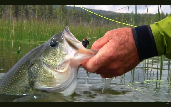
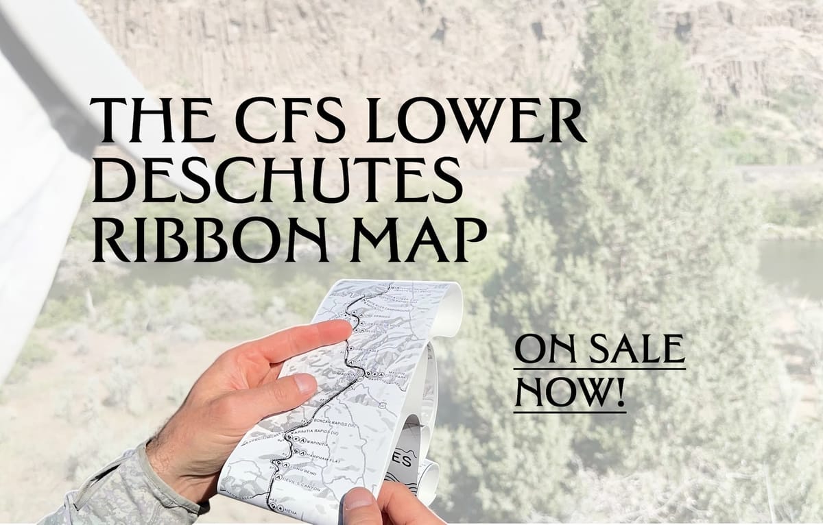
Announcing the CFS Lower Deschutes Ribbon Map
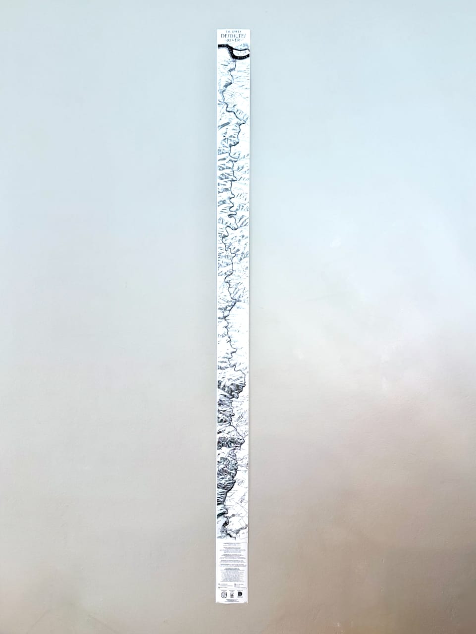
The last 100 miles. Six feet long. On sale now!

Current Flowers of State!
We made a six-foot long ribbon map of the Lower Deschutes, and every dollar raised from it goes to the river.
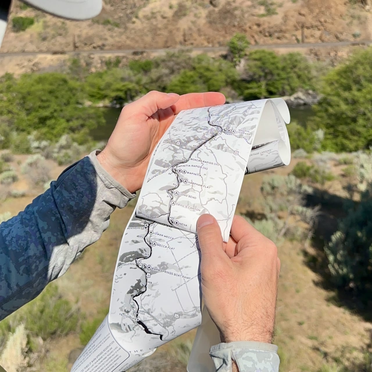
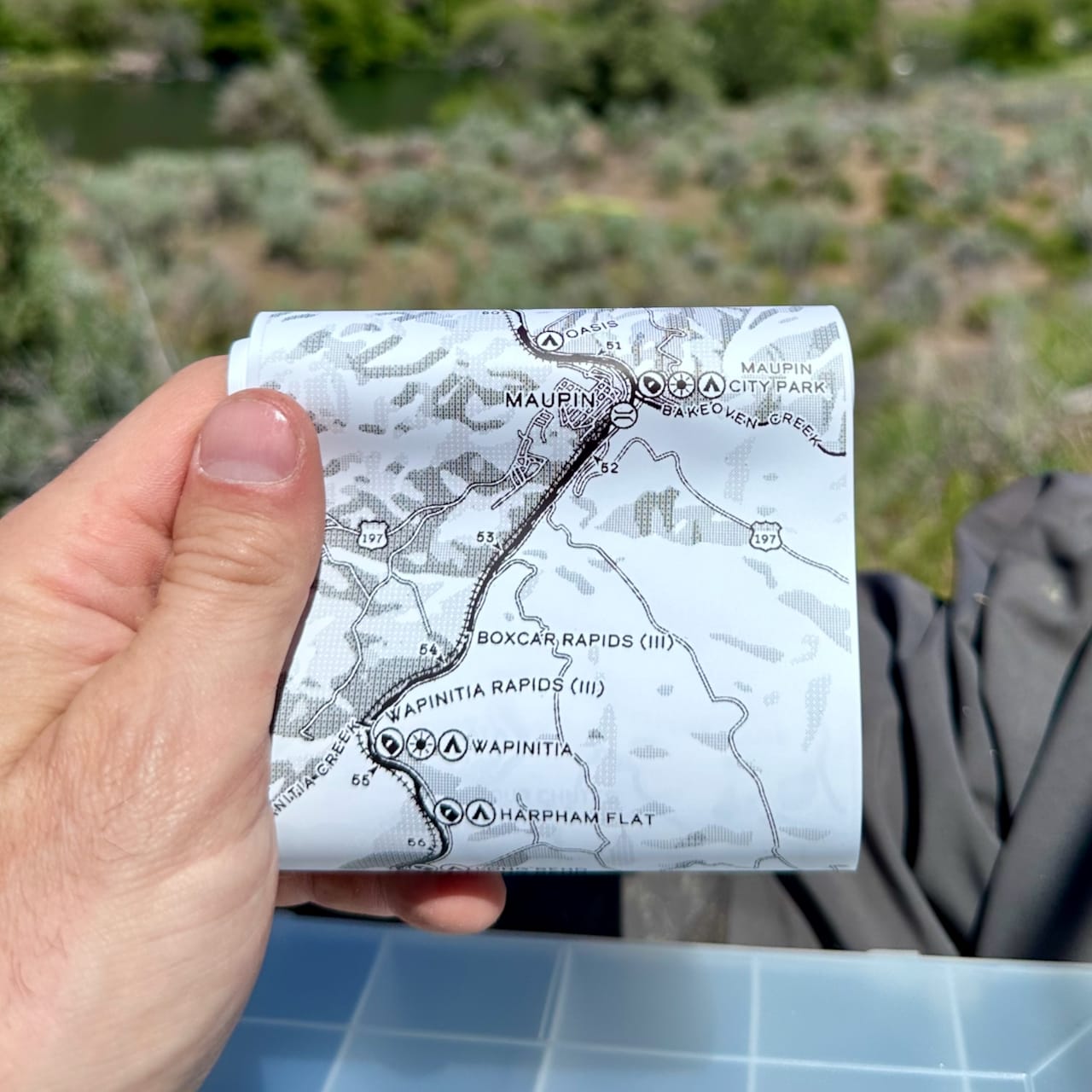
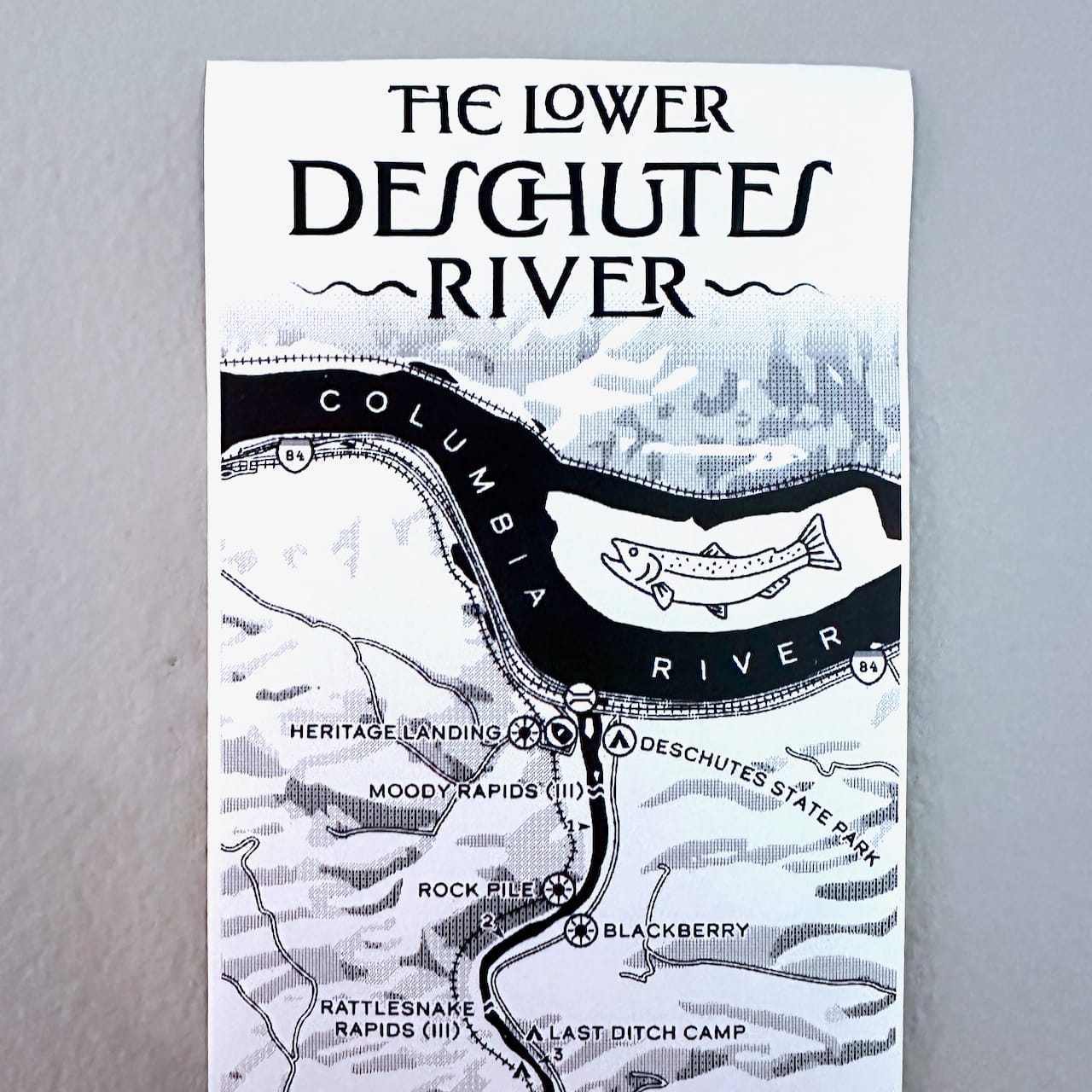
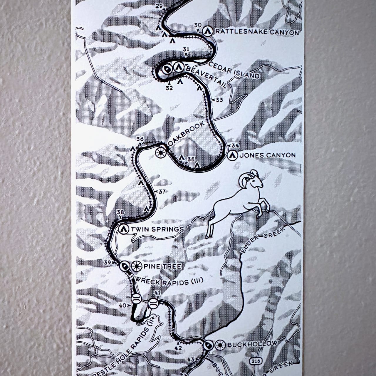
The map has almost 200 features, including campsites, day use areas, boat launches, rapids, creeks, and historical areas of interest. It's printed on waterproof, tear-proof paper and comes stored in a special tube to bring with you on your river adventures.
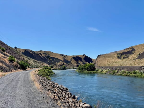
Use it to mark your favorite fishing and camping spots, make notes on the cleanest lines through rapids, or just jot down some stream-side poetry. The Lower Deschutes River corridor is one of the greatest examples of the value of public lands we have here in Oregon, a bright line of goodness where everyday folks can recreate and experience wilderness together with the rich history of the region.
Why we made a ribbon map of the Lower Deschutes
Over a year ago, a friend shared the work of cartographer Aaron Koelker. Aaron has been making all sorts of award-winning creative maps over the years, including what are called "ribbon maps". He's done them for the Wakulla and Suwannee in Florida, and even the Boston Marathon route. Ribbon maps are printed on a continuous scroll of paper, and have been traditionally used by riverboat captains on waterways like the Mississippi to aid navigation.
These days when you think fly fishing maps, you think apps. This felt like the perfect analog companion to exploration, something that you can make your own, something that's durable. Something that gets better over time. I asked myself, Would Aaron want to make one for the Deschutes?
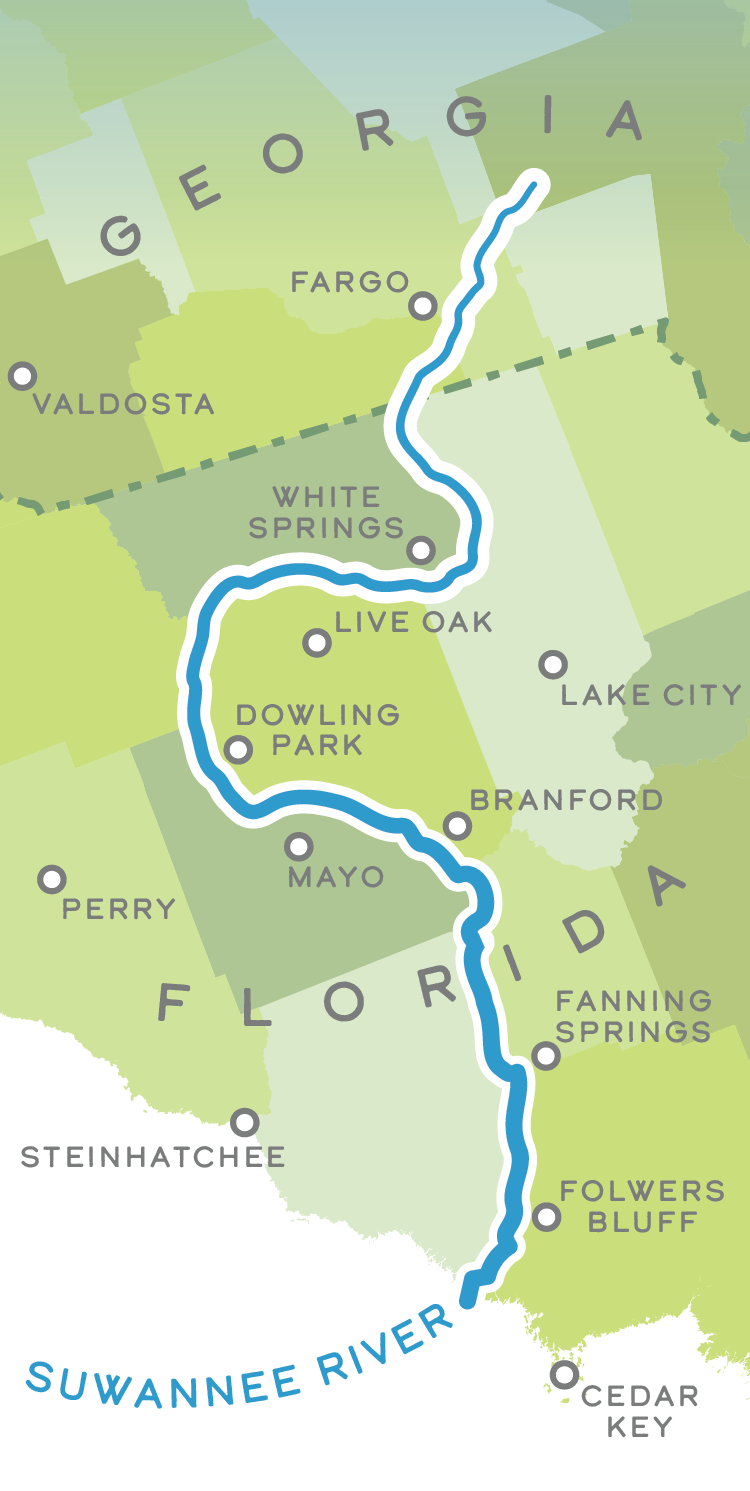
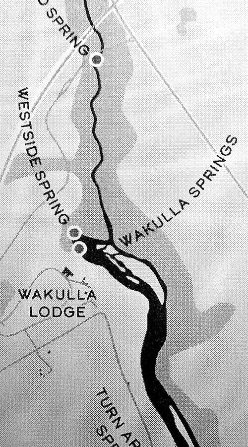
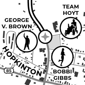
A selection of Aaron's maps, from left, the Suwannee, the Wakulla, and the Boston Marathon
I approached Aaron about working together on a project to bring his mapmaking style to the Lower D. He had done a map for a conservation groups before, was enthusiastic, and came on board immediately. "I've made a few of these ribbon maps now, but they were just for me,"Aaron says. "It was nice to make one that actually has some meaning to it. And I had just started the fall before you reached out, and that was cool timing."
Aaron had printed the Wakulla map using a receipt printer on basic receipt paper. But my mind immediately jumped to waterproof paper, and, specifically, the waterproof, tear-proof paper that the state of Washington uses to print its licenses on. Receipts fade, and the material tears easily. This will endure more than a few seasons on the water.
Benefitting the Deschutes River Alliance
The Deschutes River Alliance is fighting to restore water quality and introduce a smarter management regime to the last 100 miles of the river. It has been holding PGE, the Confederated Tribes of Warm Springs, and Oregon's DEQ accountable for degraded water quality on the river. One of the DRA's goals? Advocate for a new flow regime below Pelton Dam. It made total sense to use our efforts in making a map of the Lower Deschutes to benefit the DRA and help its fight.
So, 100% of the proceeds of our efforts are going to the DRA. Every dollar we raise selling maps is going back to the river.
You can learn more about the DRA's efforts by watching The Last 100 Miles: The Fight for the Deschutes River, a documentary that details not only the DRA's efforts, but offers an amazing introduction to the river corridor's natural beauty.

Six feet long, with hundreds of features, the Lower Deschutes Ribbon Map is your passport to adventure on one of Oregon's blue ribbon fisheries.
100% of every map sold goes to benefit the Deschutes River Alliance!
Where to find the Lower Deschutes ribbon map
We're releasing these in a limited, numbered edition. The easiest way to get your hands on a Lower Deschutes Ribbon Map is to order one through the Current Flow State Shop.
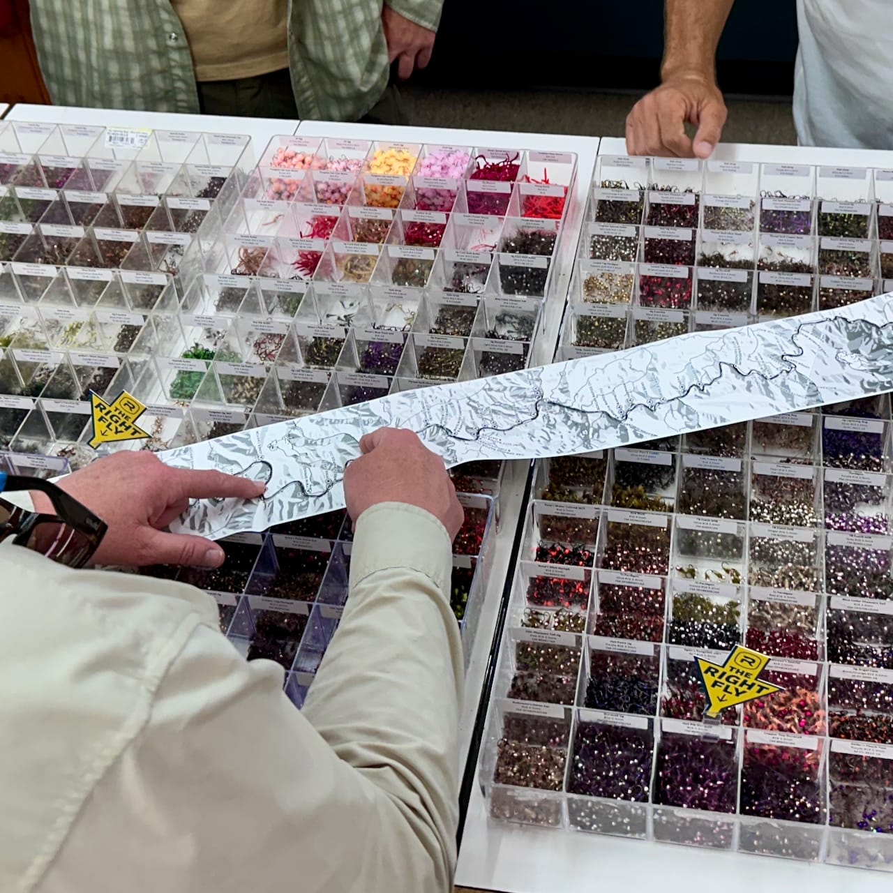
You can pick one up in person in the next few weeks at the Deschutes Angler fly shop, and at the DRA's TroutFest event, where we're having our Maupin Meetup. There will also be some available at Landdd in Portland. If you're interested in stocking the maps in your fly shop or other adventure purveyor, get in touch!
How we made the map
Aaron's approach on his previous ribbon maps was pretty straightforward (albeit labor intensive with more than a dash of techno-creative wizardry). Design the map, print it on the right equipment, and you're good. For a bigger production, with a special kind of paper, we needed to take a slightly different route. But this is still very much a cottage operation. The ribbon maps are all printed and fulfilled here in-house, at CFSHQ.
First, we had to source the right printer and materials. I went so far as to run down the exact make and model thermal receipt printer the WDFW uses to print its licenses. I wanted to be sure it could handle the special waterproof, tear-proof stock. The WDFW representative I talked with was even cool enough to give me the information of its supplier, a paper manufacturer in Oklahoma. After conversations with that company, and several other material suppliers, it became clear we weren't ready to commit to a custom run at volume, so ultimately I found an off-the-shelf stock supplier that had a material quite similar to the others.
Then, it became a matter of testing out the various dithering configurations that would best bring Aaron's map to life on our (very limited) printer. Dithering is a pretty complex process, a mathematical dark art.
Last, we had to figure out a way to package the maps so they could come with us into the field. After pondering various solutions, a discarded joint tube on the sidewalk gave me a good idea. (Usually it's the other way around, right?) Could we roll it up into one of those? Indeed we could, and I found a supplier for "doob tubes" (made in the USA!). In a different life they may have been home to bomber jibbers instead of this style of river magic. There's still plenty of room once the map is in there, for a little pen, or pinner, whatever your persuasion.
Aaron and I just had a whole conversation about the process of making the map. Expect a technical breakdown with him soon.
Made possible by CFS members
None of this could have been possible without the encouragement (financial and psychic) of CFS members. Your support is more than monetary: It gives me the courage to try and bring these creative ideas into the world, and the permission to take risks and make these sorts of things happen. So, thank you.
If you're reading this and want to show some love for the Lower Deschutes, please buy a map!
Upcoming CFS Events 📆
May 22: Casual Casting
Join us at at a free Friday nightcasting practice co-hosted with fellow CI candidate Lisa Amato. All are welcome, and rods will be provided.
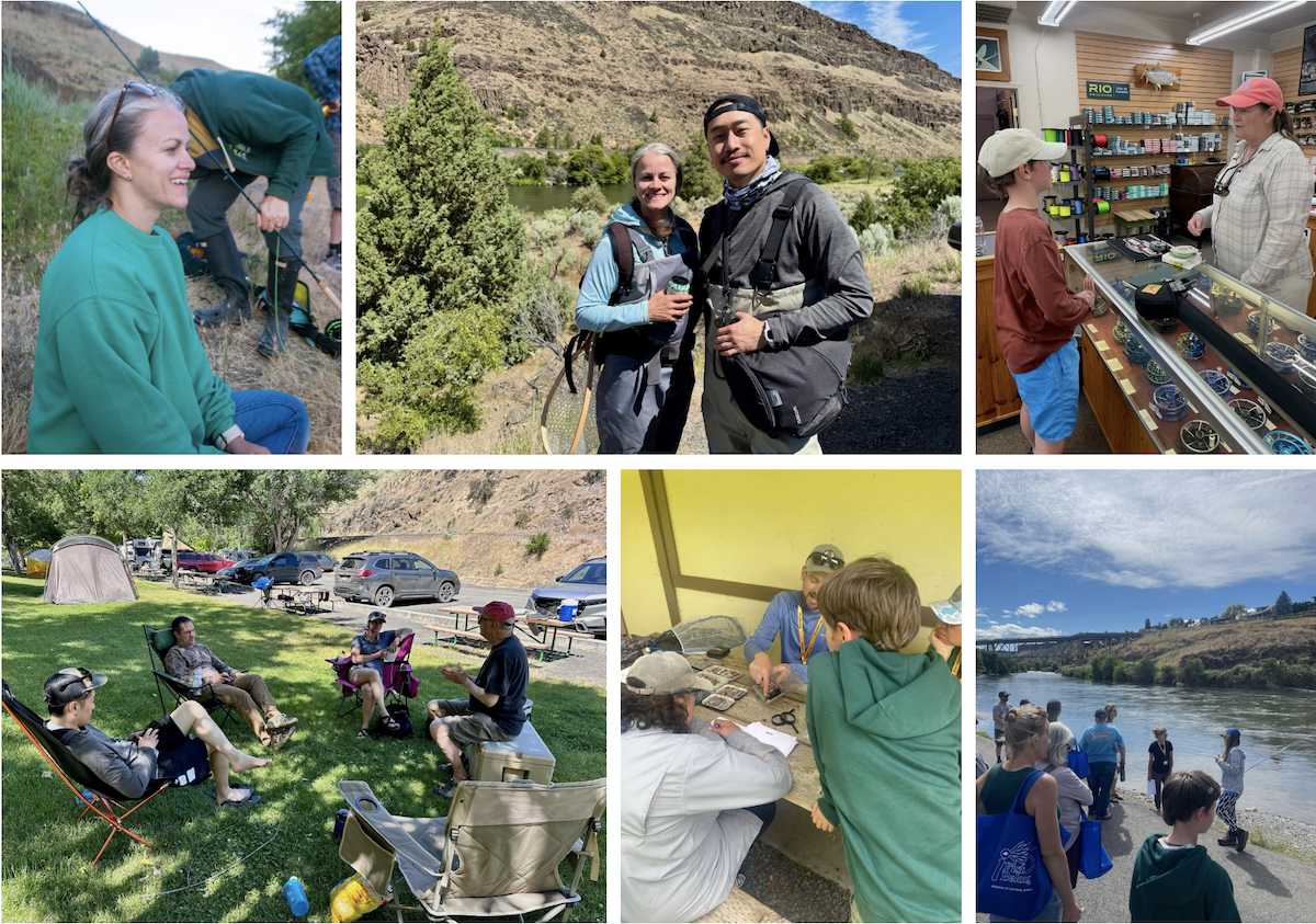
May 28-31: It's the Maupin Meetup!
The salmonfly hatch and all the beauty of late spring in the high desert will be upon us soon. Join CFS May 28-31 in Maupin, Oregon, for some classic big bug fishing and the DRA's TroutFest celebration.
June 5: Casual Casting
Join us at at a free Friday night casting practice co-hosted with fellow CI candidate Lisa Amato. All are welcome, and rods will be provided.
Got an event you want the community to know about? Send it over, and I'll include it here. You can see all of our upcoming CFS events on Luma.
That's it that's all! Current Flow State is a weekly newsletter from me, Nick Parish.
What's your favorite map? Tell me on Bluesky 🦋, Instagram 📸, YouTube 🎥, or the Fishcord 💬
If you enjoyed this, please share it with a friend. We all need more fishing buddies. 💌
Read our editorial policy or browse the newsletter archives.
CFS members support and sustain the site, and our community. Learn more about membership benefits. If you're getting value from this work, consider becoming a member and giving back.